Aerial Imagery Shows Widespread Displacement and Destruction in Gaza
Satellite maps confirm massive infrastructure collapse and humanitarian crisis
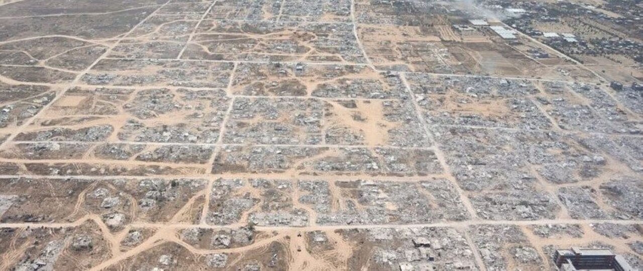
Edges of Gaza’s urban areas have been reduced to rubble and vast shanty encampments now stretch across cleared districts, according to new satellite and aerial images that document the scale of civilian displacement.
As much as 60 percent of buildings have been damaged or destroyed—including within Gaza City—leaving hundreds of thousands of residents dependent on dwindling humanitarian aid for shelter, food and water.
The visuals add urgency to international aid appeals and renewed calls for expanded ceasefires to ensure civilian protection.